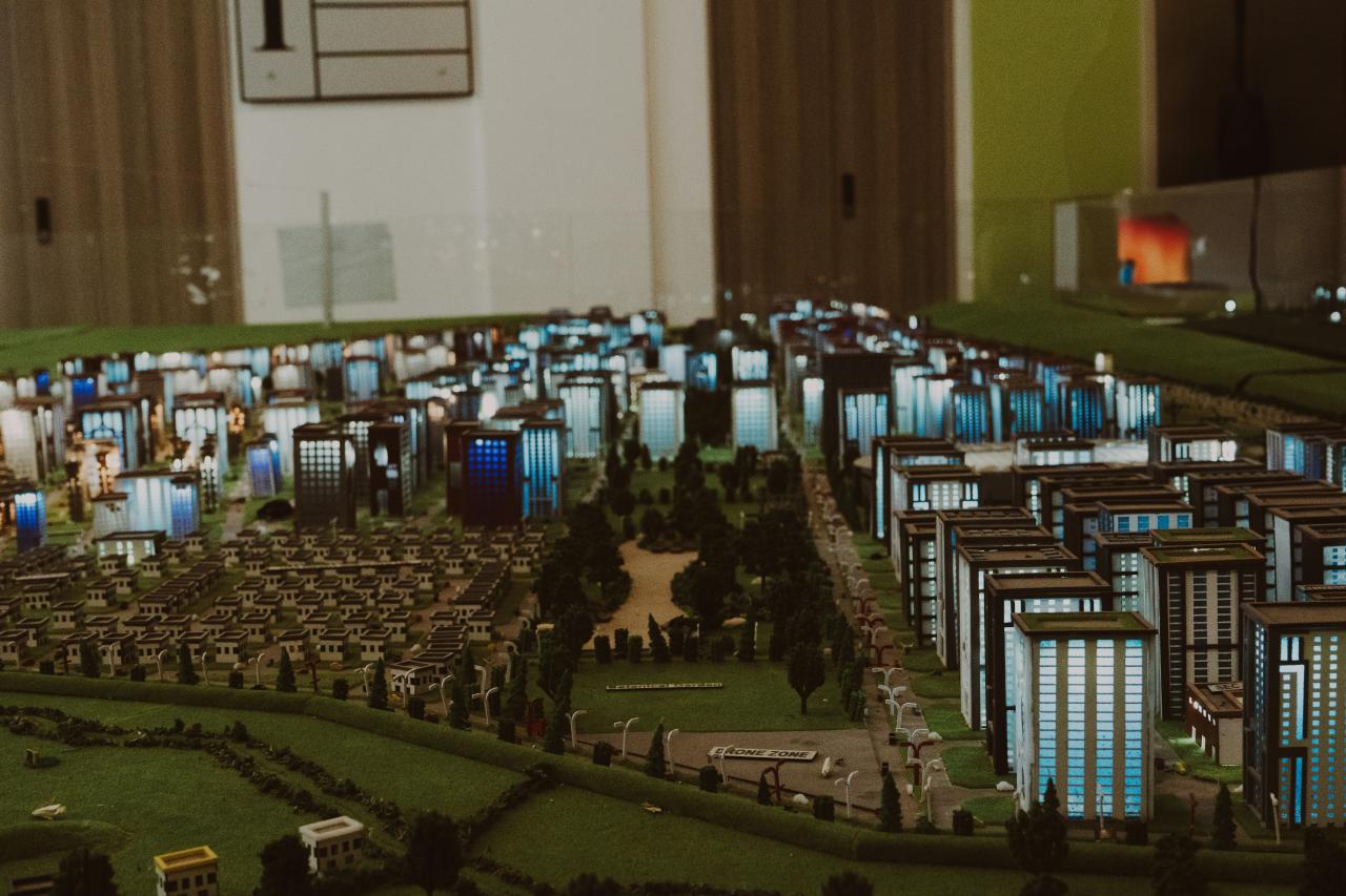
The rapid advancement of urban development has reached a pivotal moment where traditional blueprints and static maps are no longer sufficient to manage the complexities of a modern metropolis. We are currently witnessing the rise of “Local Digital Twins,” which are highly sophisticated, real-time virtual replicas of physical neighborhoods, buildings, and infrastructure systems.
These digital mirrors do not just sit as passive models on a computer screen; they are fed constant streams of data from millions of IoT sensors, satellite imagery, and social movement patterns. By creating an exact digital counterpart of a city, urban planners can now run hyper-accurate simulations to predict how a new skyscraper might affect wind tunnels or how a sudden rainstorm will impact the local sewage capacity.
This technology allows for a level of foresight that was previously considered science fiction, enabling city officials to “test-drive” urban policies before they are implemented in the real world. As global populations continue to shift toward urban centers, the need for automated, data-driven planning has become a fundamental requirement for creating livable and resilient spaces.
These digital twins serve as the ultimate bridge between the physical reality of concrete and the infinite possibilities of digital intelligence. Understanding this shift is essential for anyone interested in the future of our cities and the technology that keeps them breathing.
The Evolution of the Digital Mirror
The concept of a digital twin started in high-end manufacturing and aerospace engineering to monitor complex machinery. Architects and city planners have now adopted this technology to manage entire city blocks with surgical precision.
A local digital twin differs from a global model because it focuses on high-resolution data at a neighborhood or street level.
How Real-Time Data Feeds the Twin
A digital twin is only as good as the data that flows into it from the physical world. Thousands of sensors embedded in roads, pipes, and buildings provide a constant heartbeat of information to the virtual model.
This data allows the twin to reflect the current state of the city, from traffic congestion levels to the structural health of an aging bridge.
A. Acoustic sensors that monitor noise pollution and detect emergency sounds like glass breaking.
B. Air quality monitors that track CO2 levels and particulate matter in real-time.
C. Traffic flow cameras that use edge AI to count vehicles without compromising citizen privacy.
D. Soil moisture sensors in public parks to automate irrigation and conserve water resources.
Automating the Permit and Zoning Process
One of the most frustrating bottlenecks in urban development is the slow, manual process of approving building permits. With automated digital twins, a developer can upload a 3D model of a proposed building directly into the city’s virtual mirror.
The system then automatically checks the design against zoning laws, sunlight regulations, and environmental impact standards.
Simulating Extreme Weather Resilience
As climate change creates more unpredictable weather patterns, cities must be prepared for the worst-case scenarios. Digital twins allow planners to simulate massive flooding or heatwaves to see exactly which streets will be most affected.
This simulation data helps in designing better drainage systems and identifying where to plant more trees to reduce heat islands.
A. Dynamic hydraulic modeling to predict the path of water during a 100-year storm event.
B. Heat mapping to identify urban “hot spots” that require immediate green infrastructure.
C. Wind corridor analysis to prevent high-rise buildings from creating dangerous gusts at street level.
D. Energy load balancing simulations to prevent power grid failures during extreme temperature spikes.
The Role of AI in Predictive Planning
Artificial Intelligence acts as the brain of the digital twin, processing vast amounts of data to find patterns humans might miss. AI can predict where a pothole is likely to form or which subway line will experience the most delays next Tuesday.
By moving from reactive maintenance to predictive automation, cities can save millions of dollars in repair costs every year.
Enhancing Public Participation and Transparency
Urban planning has historically been a “top-down” process that often ignores the actual needs of the residents. Digital twins make the planning process transparent by allowing citizens to explore proposed changes through a simple mobile app.
People can see exactly how a new park or highway will look from their own front porch before a single shovel hits the ground.
A. Interactive VR portals where residents can “walk through” future neighborhood redevelopments.
B. Digital suggestion boxes linked directly to specific coordinates in the virtual city model.
C. Real-time dashboards showing the progress of public works projects and budget allocations.
D. Crowdsourced data collection where citizens can report issues directly into the digital twin.
The Integration of Autonomous Logistics
The future of urban delivery involves drones and small robotic rovers navigating our sidewalks and airspace. A local digital twin provides the high-definition map these autonomous systems need to move safely without hitting pedestrians.
The twin manages the “invisible traffic” of the sky, ensuring that delivery drones follow designated flight paths.
Solving the Urban Mobility Puzzle
Traffic congestion is one of the biggest drains on urban productivity and mental health. Digital twins allow for “Active Traffic Management,” where traffic lights adjust their timing based on real-time demand.
The system can even suggest alternative routes to commuters before they leave their homes, smoothing out the flow of the city.
A. Integration with public transit data to provide seamless multi-modal travel suggestions.
B. Automated parking management that directs drivers to open spots, reducing “cruising” traffic.
C. Dynamic bike lane expansion based on the time of day and commuter volume.
D. Pedestrian flow optimization for large events like concerts or sports matches.
Privacy and Ethics in the Virtual City
Collecting so much data about a city raises important questions about who owns that data and how it is used. Leading digital twin projects use “Privacy by Design” to ensure that individual citizens cannot be tracked or identified.
Data is aggregated and anonymized at the source to protect the civil liberties of the people living in the twin’s shadow.
The Economic Engine of Digital Twins
While the initial cost of setting up a digital twin is high, the return on investment is massive for the city’s economy. By reducing construction delays and optimizing energy use, the twin pays for itself within a few years of operation.
Tech companies and startups are also flocking to “Digital Twin Cities” to test their new urban innovations.
A. Reduced operational costs for municipal utilities like water, gas, and electricity.
B. Lower insurance premiums for the city as risk management becomes more precise.
C. Increased tax revenue from faster development cycles and more efficient land use.
D. Creation of high-tech jobs in the fields of data science and geospatial engineering.
Scaling from Neighborhoods to Mega-Cities
Most digital twin projects start small, focusing on a single high-density district or a new commercial development. As the technology matures, these “local” twins are being stitched together to create a unified model of the entire city.
Eventually, we will see national digital twins that allow for the management of entire countries as integrated systems.
The Impact on Sustainable Architecture
Architects now use the city’s digital twin to ensure their buildings contribute to the overall health of the environment. A building can be designed to “share” its excess solar energy with the neighbor next door through the twin’s management system.
This leads to a “Circular Economy” where waste and energy are managed at a community level rather than an individual level.
A. Automated carbon footprint tracking for every building within the digital twin’s jurisdiction.
B. Optimized placement of rooftop gardens to maximize urban biodiversity and cooling.
C. Integration of “Gray Water” recycling systems across multiple adjacent properties.
D. Use of the twin to source local, sustainable building materials for new construction projects.
Overcoming Technical Hurdles
Building a digital twin requires immense computing power and extremely low-latency communication networks like 6G. Interoperability is also a challenge, as different departments often use different software that doesn’t talk to each other.
Standardizing the data formats for digital twins is currently a top priority for international urban planning organizations.
The Future: The Living, Breathing City
In the coming decade, the digital twin will become more than just a tool; it will be the operating system of the city. Buildings will talk to the grid, cars will talk to the roads, and the city will learn to heal itself from damage.
We are moving toward an era of “Self-Organizing Cities” that can adapt to the needs of their citizens in real-time.
Conclusion
The implementation of local digital twins is changing the very soul of urban management. We are finally moving away from the guesswork that has plagued city planning for centuries. These virtual models provide a safe space to innovate and solve our most pressing urban problems.
The automation of permits and zoning will lead to faster and more sustainable growth for everyone. Residents are now empowered with more transparency and a louder voice in their city’s future.
Our cities are becoming smarter, safer, and much more resilient to the challenges of climate change. The marriage of AI and geospatial data is the most important development in modern architecture. We must remain vigilant about data privacy while embracing the efficiency these twins offer us.
The future of humanity is urban, and that future is being written in the code of digital twins. A well-managed city is no longer a dream but a technical reality that we can achieve together.